4590 17th St
San Francisco, CA 94114
USA
Thinkwalks presents an exploration walk:
Water History of Cole Valley & the Panhandle—EVENT FULL
(but a second one will be scheduled by request)
My most recent water research turned up an amazing fact: There was one (and only one) creek that was strong enough to part the sands.
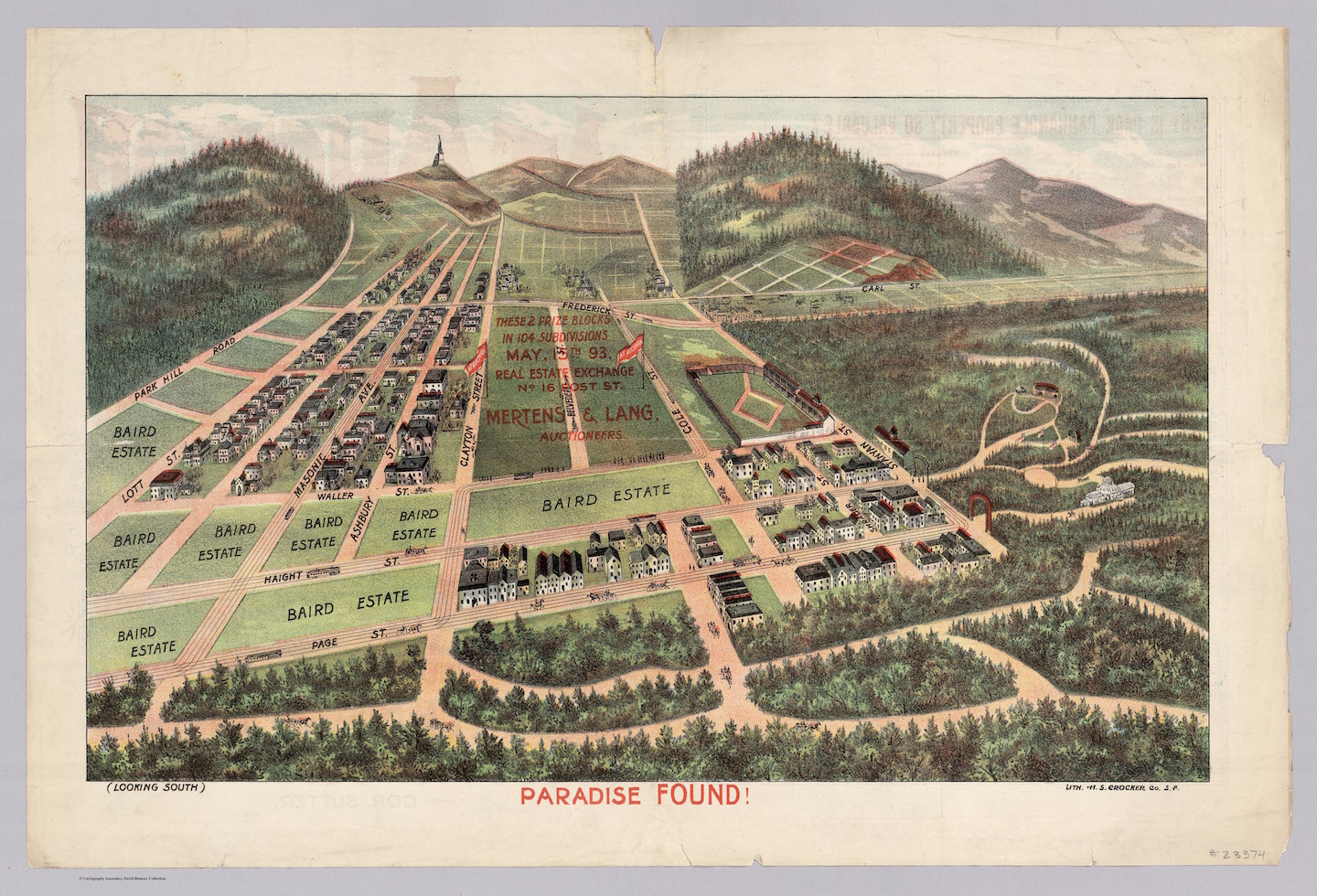
This 1893 real estate drawing shows the Panhandle in the fore and Cole Valley behind (looking South).
The source of that creek was Cole Valley and its upper slopes. The 37 and 33 bus lines will get you to this hilltop starting point. From there we’ll walk to three viewpoints and explore springs on the hilltops. Then we’ll descend into Cole Valley past the former site of a lake (with old photos!) to end at Oak Street, where a creek was mapped in 1869—the only creek mapped wholly within the dune area of San Francisco.
Topics: Dune hydrology, bedrock springs, reservoirs, extreme weather, old maps pictures.
☆ RSVP required
↪ Rain or shine
↪ Some steep hills! But also lots of standing discussion, so you may get chilled if you forget your extra layers. It may be very windy.
↪ Ending near Oak & Ashbury
↪ Maximum 12 people